
Scope
The fire and post-fire debris flow infrastructure vulnerability project is developed by ASU's Resilient Infrastructure Lab. The project is focused on developing innovative methods for assessing the vulnerability of roadways and power infrastructure to wildfires and post-fire debris flows. Case studies have focused on California and Arizona. The research has produced first-of-its-kind probabilistic assessments of roadway and power infrastructure fire and post-fire debris flow risk, considering the likelihood of fires and precipitation today and under climate change futures, and the characteristics of watersheds.
Model Inputs:
-
The 30-meter digital elevation model (DEM) provides the slope, ruggedness, and elevation range of topographical features. The DEM is also used to derive the stream networks and the watershed boundaries.
-
2 to 100 year Design storms.
-
Data on wildfire potential.
-
Soil data of clay content and liquid content to characterize ground properties.
-
Extreme precipitation and wildfire forecasts based on ensembles of Global Climate Models under climate change scenarios.
-
Subbasin watersheds .
-
Roadway networks and their betweenness centerality.
Arizona Roadway Vulnerability

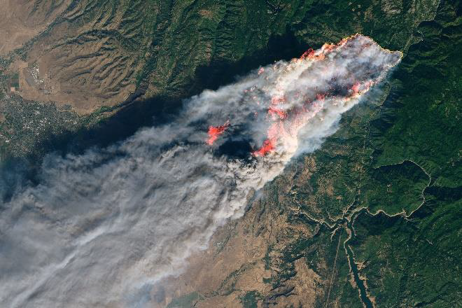
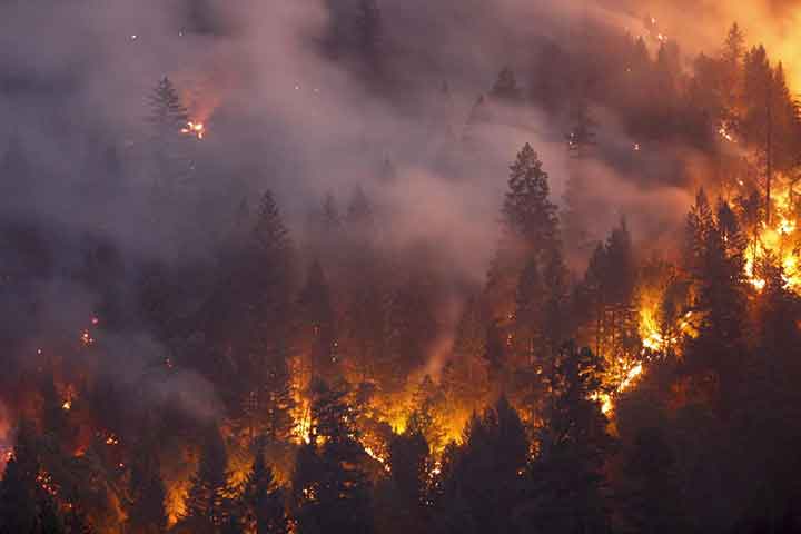
Wildfires have grown in number, size and intensity in the American West and forecasts predict worsening trends. Evidence mounts that post-fire debris flows pose a major hazard to infrastructure, particularly roadways. Vulnerabilities of assets to post-fire flows requires consideration of geologic, vegetative, and hydrologic conditions. A model that considers environmental conditions, post-fire effects, and transportation asset use is developed, and applied to a fire prone region in Arizona. 17% of watersheds have a greater than 20% chance of post-fire debris movements and flooding under a minor precipitation event. Additionally, there is a greater than 50% probability of post-fire debris flows where recent fires have occurred, validating the underlying model. The model shows the vulnerability of infrastructure to environmental and technological variables, drawing attention to the need to manage the risk as a broader system.
Publication documenting our methods and results:
A Fraser, M Chester, and BS Underwood, Wildfire risk, post-fire debris flows, and transportation infrastructure vulnerability, 2022, Journal of Sustainable and Resilient Infrastructure, 7(3), pp. 188-200, doi: 10.1080/23789689.2020.1737785.
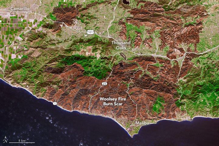
California Roadway Vulnerability

Post-wildfire debris flows represent a significant hazard for transportation infrastructure. The location and intensity of post-fire debris movements are difficult to predict, and threats can persist for several years until the watershed is restored to pre-fire conditions. This situation might worsen as climate change forecasts predict increasing numbers of wildfire burned areas and extreme precipitation intensity. New insights are needed to improve understanding of how roadways are vulnerable to post-fire flows and how to prioritize protective efforts. Using California as a case study, the vulnerability of transportation infrastructure to post-fire debris flow was assessed considering geologic conditions, vegetation conditions, precipitation, fire risk, and roadway importance under current and future climate scenarios. The results showed significant but uneven statewide increases in the number of vulnerable roadways from the present to future emission scenarios. Under current climate conditions, 0.97% of roadways are highly vulnerable. In the future, the ratio of vulnerable roadways is expected to increase 1.9-2.3 times in the Representative Concentration Pathways (RCP) 4.5 emission scenarios and 3.5-4.2 times in the RCP 8.5 emission scenarios. The threat of post-fire debris flow varies across the state, as precipitation changes are uneven. The vulnerability assessment is positioned to 1) identify, reinforce, and fortify highly vulnerable roadways, 2) prioritize watershed fire mitigation, and 3) guide future infrastructure site selection.
Publication documenting our methods and results:
R Li and M Chester, 2023, Vulnerability of California Roadways to Post-wildfire Debris-flows, Environmental Research Infrastructure and Sustainability, doi: 10.1088/2634-4505/acb3f5.
The results were initially developed in partnership and with support from the the UCLA Institute of Transportation Studies: Chester M and Li R, 2020, Vulnerability of California Roadways to Post-Wildfire Debris Flow, UCLA Institute of Transportation Studies, Report No. UC-ITS-2020-38, doi: 10.17610/T60W35.
California Power Vulnerability

Wildfires and post-fire debris flows (PFDFs) threaten California infrastructure and are evolving with climate change. There is significant focus on the threat of utility-caused wildfires because electric power equipment has triggered wildfires leading to major damage. California's ambitious climate targets rely on electrification of transport and industry. As the state modernizes its electricity system to support increased demand, it must consider future climate hazards. To date, there is no rigorous characterization of the intersection of future fire threat, PFDFs, and electrical infrastructure. We estimate wildfire and PFDF threat to transmission lines, substations, and power generators in California and assess vulnerability of electric utilities by intersecting electrical infrastructure and current and future wildfire and PFDF threat, using two global climate models and two representative concentration pathways. We find clean, dispatchable power generators (e.g. hydroelectric and nuclear) and small, publicly-owned utilities are most vulnerable. Increasing threats will require additional resources and consideration of future threat distribution.
Publication documenting our methods and results:
E Hennessy and M Chester, 2025, Electric utility vulnerability to wildfires and post-fire debris flows in California, Environmental Research Infrastructure and Sustainability, doi: 10.1088/2634-4505/adb90a.
Selected Documentation

Electric Utility Vulnerability to Wildfire and Post-Fire Debris Flow in California
Environmental Research Infrastructure and Sustainability, E Hennessy and M Chester, doi: 10.1088/2634-4505/adb90aPublished: 2025

Fire and Post-Fire Debris Flow Roadway Vulnerability
Transportation Research Board, M ChesterPresented: Jan. 2025

Electric Utility Vulnerability to Wildfire and Post-fire Debris Flow in California
International Society for Sustainable Systems and Technology, E HennessyPresented: 2024

Cross-boundary Risks of Hinterland Hazards to City Infrastructure
Environmental Research Infrastructure and Sustainability, M Joines et al., doi: 10.1088/2634-4505/ad5fb4Published: 2024

Vulnerability of California Roadways to Post-wildfire Debris-flows Data
ASU Dataverse, doi: 10.48349/ASU/OIBSRWPublished: 2024

Vulnerability of California Roadways to Post-wildfire Debris-flows
Environmental Research Infrastructure and Sustainability, R Li and M Chester, doi: 10.1088/2634-4505/acb3f5Published: 2023
Wildfire risk, post-fire debris flows, and transportation infrastructure vulnerability
Journal of Sustainable and Resilient Infrastructure, 7(3), pp. 188-200, A Fraser, M Chester, and BS Underwood, doi: 10.1080/23789689.2020.1737785Published: 2022

Vulnerability of California Roadways to Post-Wildfire Debris Flow
UCLA Institute of Transportation Studies, Report No. UC-ITS-2020-38, R Li and M Chester, doi: 10.17610/T60W35Published: 2020
Managing Wildfire Risk, Precipitation, and Transportation Infrastructure
Transportation Research Board, A Fraser, M Chester, and BS UnderwoodPresented: Jan. 2019